August 29, 2009

The Celebration at the end of the walk
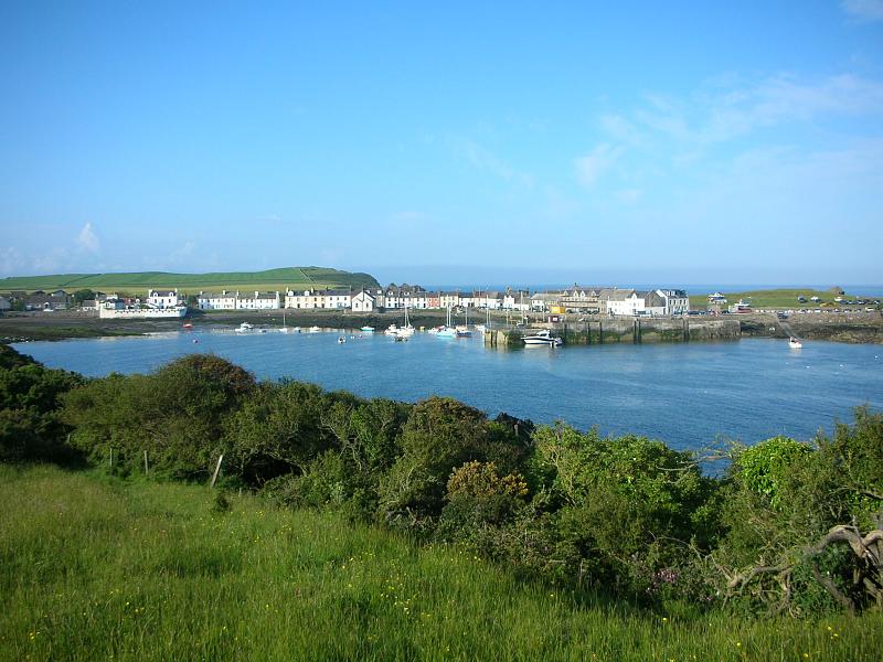
The final day – a 9 mile walk from Annan to Gretna and as you can see from the photo above I was joined by some friends and family who had helped me way or another at some time during the last five years.
I’d also like to thank all my Blog followers – your comments along the walk were always welcome. I have around 70 people reading my blog a day and it seems strange to think that there are “real people” out there who have read my posts.
After 5 years and about 2000 + miles later its difficult to conceive of “an end” to this walk. The end point was for so long always so far in the distance both in actual miles and also time, that it was only on the last day that I started to come to terms it would soon all be over.
My next aim is to try and get a book written and published – if that comes to pass then I’ll post the details here but meantime if you are interested in walking part (or all) of the Scottish Coast then please visit www.nationalcoastalpath.co.uk where I intend keeping everyone informed of any developments regarding an “Official” National Coastal Path for Scotland.
Thanks again everyone,
Gil Campbell
29th August 2009
 13 Comments |
  life, photography, Scotland, trail, Travel, Uncategorized | Tagged: Annan, Gretna, Scottish Border |
  Permalink
 Posted by treb123
August 27, 2009

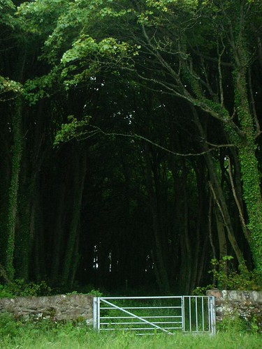
On my last day I went down and walked the final 9 mies or so from Annan into Gretna and a few of my friends and family came down to walk a mile with me. Above is a photo of my mum and dad fooling around in the high wind when it was there turn to accompany me. I got down to Annan about 5 and intended to do a radio interview for Radio Scotland whilst walking – but as I drove out of Annan I realised that I wouldnt be able to get a decent telephone signal and therefore would have to hang about in Annan until the interview was completed. It was mercifully short and sweet and I was soon back at Ruthwell and enjoying a lovely warm sunny evening along some minor country roads towards Powmill.
2 Comments | life, photography, Scotland, trail, Travel, trek, walk | Permalink
Posted by treb123
August 26, 2009

Nosey Bullock
I caught the bus back to Dumfries from Caervlaverock castle and it was really interesting to see how friendly everyone was. Everyone, and I mean everyone who got on the bus at various stops on the way to Dumfries said hello to everyone else on the bus. I half expected a deep bow as well and was mildly disappointed that I didnt see that. But nevertheless the friendly attitude was unexpected and very welcome. If you said hello to anyone on an early morning bus in Edinburgh the passengers would scream in unison that there was going to be a murdurr.
I was joined half way along my walk by my sister Anna and her Dutch friend Wilco who joined me for the second part of the walk. We met at Caerverlock castle just as they were setting up for the annual medieval fayre. Wilco is a good friend and has spent some time living in the jungles of Brazil. It was good to see him again and I appreciated the fact that he took time out to see me on what was only a flying visit to Scotland.
Next week will be my final two days on my walk – only 16 miles to go and I’m looking forward to friends and family coming down to walk the final few miles to Gretna with me.
If you are interested in the idea of a National Coastal path for Scotland please visit my “sister” site which I have set up to lobby for the path’s creation. The site is www.nationalcoastalpath.co.uk
3 Comments | life, photography, Scotland, trail, Travel, trek | Permalink
Posted by treb123
August 16, 2009

After yesterday’s long but enjoyable walk I wasnt in any mood to get up early and charge headlong up the road to Dumfries. So I decided to walk to New Abbey which was only about 8 miles up the road. I fortified myself with coffee and scone at the Abbey tearoom and then headed back to the start of the walk at Carsethorn.
Apart from the start of the walk along a minor road, the rest was a straightforward section north along the A710 towards Dumfries. Im edging towards the end of the walk and I’m running out of miles. For the first time I’m actually starting to wonder of “life after my coastal walk”.
I can imagine what it must be like to be an athlete training for the Olympics – after all the training and the journey to get there abruptly verything ends in a matter of moments. I’m faced with the same scenario – as soon as I step over the Border the journey of five years will be complete.
For me there has never really been a “goal” as such – the “process” of the actual journey has always been the most important point to this venture. At the beginning of the walk the end point seemed so far in the future, that a goal seemed non nonsensical. The goal was just to walk and keep walking. Now that I have set an end point I have to decide what to do next. Perhaps another walk – who knows…..
Leave a Comment » | life, photography, Scotland, trail, Travel, trek | Tagged: Carsethorn, Dumfries, New Abbey | Permalink
Posted by treb123
August 15, 2009

Southerness Lighthouse
Today the weather was much improved over yesterdays horrendous non stop rain. I initially thought that I could go across Sandyhills Bay and ford the river (Southwick Water). However the tide was coming in and I had been advised that tides are very quick and that the river would fill first and so after walking a mile or so I decided that it was too risky to take the chance and turned round and reluctantly headed for the main road which climbed above the bay.
The area is infamous for its fast tidal waters and quicksands so I think I made the right decision to avoid the shore on this occasion. I had been told last week in a church cafe at Dundrennan of two people who had go caught out trying to walk to Heston island and had got stuck in the mud and drowned when the tide came in – I didnt want to sufer the same fate as those two unfortunate souls.
After by-passing the river by walking to Caulkerbush, the road turned south and headed towards the Mersehead wildlife reserve, and the long stretch of beach that headed east towards Southernness. Southerness is characterised by one of the oldest lighthouses in Scotland which unusually is square shaped rather than round.
After stopping at the hotel for a quick coffee I set off again towards Arbigland and Paul Jones Cottage. Unfortunately my gps was showing a path which turned out to lead deeper into overgrown nettles, wild roses and various other flora that ganged up to scratch and tear at my skins and clothes. I trained vainly to battle me way towards what I could see was the back of an orchard but gave up as the brambles and bushes were just too dense. I couldnt believe it – this was the first time in the whole of my walk that had been in such a ridiculous situation like this. (I’d been in plenty of ridiculous situations – but this was a new variety). I decided to backtrack as my battery on my map/phone/gps XDA device was just about done and I had visions of thrashing about in the dark if I didnt get my act together.
Eventually I came into a clearing that led into the grounds of what I presumed was Arbigland and by now my phone was flat as a pancake. Eventually I got back by following minor roads and using my uncanny and keenly developed sense of smell, although by now it was dark and 9.30 at night. Jings what an adventure.
2 Comments | life, photography, Scotland, trail, Travel, trek, walk | Tagged: Arbigland, Caulkerbush, Dundrennan, Heston Island, Mersehead, Paul Jones Cottage, Sandyhills, Southwick | Permalink
Posted by treb123
August 14, 2009

Happy Days are here again
Tempus fugit and all that. Since I announced that I was going to finish my walk on the 29th August I realised I’d better get my skates on and play catch up. I don’t want to stumble over the finish line knackered at Gretna, and so I decided to do a very short final day from Annan to Gretna of around 8 miles.
The problem was when I drove down on the Friday the rain was chucking it down heavily – probably the rainiest day of the summer this year. But I had to press on despite the weather. The little harbour at Kippford was deserted as the rain poured down. The wind and the rain kept all sensible people indoors. However the path up around the cliffs towards Rockcliffe was a good one and it was quite exciting to stand at the top of the cliffs and watch the wind whip up the froth on the waves far below.
I was happy that the wind was blowing onshore from the sea as the gusts were strong and I wouldn’t want to be leaning inland constantly to avoid being blown off into the sea. How ironic would that be with 30 miles to go?
Leave a Comment » | life, photography, Scotland, trail, Travel, trek, walk | Tagged: kippford, rockcliffe, Sandyhills | Permalink
Posted by treb123
July 26, 2009

Kippford
I left Dalbeattie with a heavy heart promising it’s good people that I would one day return. Actually I was thrown out the pub for being drunk and incapable. I staggered down the road sipping from my camelback water container which was now filled with drambuie and coke. I suddenly could understand all the secrets of the Universe and was anxious to get to a place where I could scribble down my insights for the benefits of all the peoples on the planet, and not just the citizens of Dalbeattie and its environs.
Ok this didn’t really happen (well not all of it) but I wanted you to get an insight into the kind of rubbish that goes through your head when you are busy playing Russian roulette with traffic. Thank God I wont have much more of these crazy mental meanderings to entertain – although I am wondering if I should hop the last 6 miles for a laugh. A ha ha ha.
1 Comment | life, photography, Scotland, trail, Travel, trek, walk | Tagged: Dalbeattie, kippford | Permalink
Posted by treb123
July 25, 2009

Auchencairn Millenium Garden
Today was a road walk up to Dalbeattie from Auchencairn. Unfortunately I cant remember much about it except it was just another road walk. I stopped at Palnackie for a coffee but the rest is blank, sorry. Thats one of the hazards of writing a blog 2 weeks after the event. I end up spending a day playing catch up and for those who read my blog on a regular basis, I usually just pour out any old codswallop, usually entirely unrelated to the events of that day. A “stream of consciousness” I think is the artistic (or Freudian) term. Well thats what you are getting now dear reader – the equivalent of literal mince. A road’s a road for a’ that (with apologies to the National Bard) but there is only so many ways I can describe tarmac and rain.
Oh yes, had a scone at lunch time, but thats old news isnt it?
Leave a Comment » | photography, Scotland, trail, Travel | Tagged: Auchencairn, Dalbeattie, Palnackie | Permalink
Posted by treb123
July 24, 2009

MacLellan's castle in Kirkcudbright
Today I saw the first signpost for Gretna and I have to admit it felt strange as I had a sudden realisation that my big walk would soon be over. Most of the time my mind is preoccupied with the logistics of my walks – getting from A to B and back again, planning where to park my campervan and wondering how to get back to the start of my walk each day. But now I realise I have only about 50 miles to go till I reach the border at Gretna and my journey will be over.
I decided that I will finish my walk on Saturday August 29th, and some of my friends and family have kindly agreed to come down on my last day to walk the last few miles with me. Im trying hard not to think about the end. Something in me is going to change I know that. It has been a big part of my life for four years now and its become a “way of life” almost. I will have to find another project to replace this one once I’m done. What I do know is that I would certainly recommend the coastal walk to anyone who wants to attempt it.
I have been working hard behind the scenes to get a National Coastal Path for Scotland established – I really think the time has come to create a long distance path to match the Appalachian trail in the USA and the Pacific Coastal trail. Our scenery is second to none and and Im sure if the Scottish Government had the will the path will be created.
Watch this space!!!
1 Comment | life, photography, Scotland, trail, Travel, trek, Uncategorized, walk | Tagged: Auchencairn, Dundrennan, Kirkcudbright | Permalink
Posted by treb123
July 17, 2009

- Kirkcudbright
A short walk north towards Kirkcudbright – after spending the night parked up on the harbour and listening to a torrential downpour all night it was a relief to wake up to a clear morning. Today was going to be a quick walk up to Kirkcudbright and then a walk around the little peninsula which is called St Mary’s isle.
I got there in no time and Ronnie and I had a look around the little town. There was a castle in the middle of the town, MacLellan’s castle, and there was a look of quiet elegance about it.
2 Comments | life, photography, Scotland, trail, Travel, trek, walk | Tagged: Brighouse Bay, Kirkcudbright | Permalink
Posted by treb123
July 17, 2009

Light at end of the tunnel
I left Gatehouse of Fleet on my walk around the peninsula that lies to the south of the A75 and goes around Borness Point and then north again to Kirkcudbright. After beating down some nettles to get down off the main A75 and onto a small farm road that led south towards the caravan park at Sandgreen. The path went through some lovely woodland and with Fleet Bay to my right. I had decided to announce the date of my last day’s walk which will be on the 29th of August and I invited my friends and family who had supported me to come down to walk a mile with me. I’m kind of looking forward to the end but also apprehensive – I will need to come up with a new project that is equally silly or I’ll panic. Like a diver who has been immersed at depths and has caught the “bends”, I will need to come up with my own version of a decompression chamber to cope with the change.
However I didn’t want to get ahead of myself but I also realised I’d have to get my skates on as time was running out on me. The beach at Sandgreen was lovely and their was a few kids from the caravan park playing on the sands. From the beach the route went along a track to Carrick which was really just a collection of holiday huts of various ages. Then the path came onto the minor road that is also on the SUSTRANS national cycle network.
At a place called Knockbrex there were three navigation pillars that poke out of the water – Im not sure how they got there or how old they are but they were important enough to be noted on the O.S Map The rest of the way was pleasant enough with a couple of interesting features along the way – a tower at Corseyard and then an old Kirk at Kirkandrews.
The rest of the road was mainly down a long straight road towards Brighouse where the path eventually took me out at the very busy caravan park at Brighouse Bay.
Leave a Comment » | life, photography, Scotland, trail, Travel, trek, Uncategorized | Tagged: Brighouse Bay, Kirkcudbright, Sandgreen | Permalink
Posted by treb123
July 16, 2009

- Fleet Bay
Only a short walk to round off a short weekend. I drove the van in and parked it the Cardoness castle car park, then waited for the bus to take me to a few miles up the road where he dropped me off at Kirkdale bank. I managed to get off the main A75 for a short time by taking the minor road above the hill which afforded me good views of across Fleet Bay and the peninsula I would be heading to next time Im down.
Leave a Comment » | life, photography, Scotland, trail, Travel, trek, Uncategorized, walk | Tagged: Gatehouse of Fleet, Kirkdale | Permalink
Posted by treb123
July 15, 2009

Creetown
The walk today was heading south along the east bank of the Cree River. Unfortunately most of it was along the very busy A75 which carries heavy traffic towards and away from Dumfries. Apart from a diversion I made into Creetown, most of the way was along this very busy main road. So I was doing my one-foot-on-the-verge peg leg dance a lot of the way.
I stopped off in a cafe for a coffee and was transported back about 50 years to a place that had barely changed in all that time. The old couple that ran the cafe looked as if they had bought the place about 1960, filled it up with jars of sherbet lemons and the like and had then done nothing to the place since. I enjoyed a good salad roll there and a coffee and listened in to a “conversation” between the owner and what I took was an old retired farmer. It was entirely one sided with the the owner asking questions and the farmer occasionaly saying “aye”. Is this what happens to old men? They have nothing to say? Maybe I could learn from them – I spend so much time walking along living in my own head that when I do get a chance to have a chat it can come out like verbal diarrhea. Perhaps the old men have said everything that needs to be said and don’t want to waste their breath. I used to think that everyone had only a certain number of words that they could say during their lifetime. When your quota ran out, then you would be struck dumb for whatever years you had left. There is something attractive about that idea – perhaps people would think before they speak – choose their words carefully and not ramble on.
I wonder how many words I have left to……….
Leave a Comment » | life, photography, Scotland, trail, Travel, trek, Uncategorized | Tagged: Creetown, Kirkdale, Newton Stewart | Permalink
Posted by treb123
July 14, 2009

Newton Stewart
The walk from Wigton to Newton Stewart wasn’t a long one and it followed the minor road that led along the river Cree’s Estuary west bank. Eventually the minor road led back onto the main A road near St Ninian’s well and the approach to Newton Stewart was along side the river bank. A brand new cycle path had just been opened which saved me from walking along the main road – these SUSTRANS cycle paths are a real boon and I’m sure that over time enough of them will be constructed to link large sections of paths that would otherwise are dangerous to walk along.
I walked under the main road through the underpass and read the following caption that had been written on the concrete (see Photo)
“My waters always know their course to rivermouth from hilltop course
Man’s destination is unkent until his journey is fully spent”
Im not sure where the poem comes from but walking reading the quotation struck a chord with me.
In no time I was in Newton Stewart and I was walking along when I saw a young girl carrying a baby – however she did look a bit young and when I looked closer I realised it was a doll she was carrying. The girl must have been about 15 so it didnt seem to be a toy to her. I thought it was odd until I spotted another girl sitting on a park bench and cradling another doll. It seemed like I was walking into an episode of a “League of Gentlemen” – it was very bizaare.
I mentioned this to a friend a few days later and I was told that it was perhaps the policy for health or the education services to allow teenage girls see what it was like to actually look after a baby – presumably to put off teenage pregnancies. The girls looked happy enough and if anything it appeared to me to be a crude mating signal to adolescent boys! I’m sure I will be enlightened by someone…..
More Photos
Leave a Comment » | photography, Scotland, trail, Travel, trek, Uncategorized, walk | Tagged: Newton Stewart, St Ninian, Sustrans, Wigton | Permalink
Posted by treb123
June 15, 2009

This was a shortish walk of around 7 miles. The route followed thebay around Garlieston and then follwed the path out towards Eggerness point. A squelchy mud track led into the cool of a woodland which eventually led back onto the B7004 minor road which then met the A714 into Wigton.
Wigton is a booktown and has the largest second hand book shop in Scotland. There seemed to be about 5 bookshops in the little town and I heard that Wigton’s status as a “Book Town” came about from a competition that was aimed to increase the revenue of the town after some local industries shut down.
I liked Wigton and had one of the best scones in a cafe (cum bookshop) I have had on my travels. Scones are the equivalent of carrots to a donkey for me. I can smell the scent of a freshly baked scone on the breath of a zephyr from 5 miles out.
More Photos
Leave a Comment » | life, photography, Scotland, trail, Travel, trek, Uncategorized, walk | Tagged: Garlieston, Scottish Coastal Path, Wigton | Permalink
Posted by treb123
June 14, 2009

Cool Woods on way to Garlieston
It was another hot day and the flies were waiting to accompany me on my walk. Flies are so dependable. The first part of the walk was along minor roads and thats about all I remember. Sorry. But thats what happens. I walk for a few days – I upload my photos onto Flickr. Then when I come to write my blog I stare at the OS map on my computer and try to remember where Ive been, what I saw of note and how to make this blog scintillating and exciting for you, dear reader.
But every minor road takes on the appearance of another minor road. Sometimes I get flashbacks when the curve of a road will remind me of another perhaps a thousand miles away. The constants are the smells – and the colours and the sounds and the light. The feel of sweat cooling on my back on a hot day and the smell of a warm t shirt I have been wearing all day. The smell of carrion and road kill. The smell of sweet honeysuckle and wild roses growing in the hedge rows. The sounds – oyster catchers with their wheeling high pitched warning squeals of alarm. Invisible skylarks pinned to the blue skies overhead. The burst of the delicate wild flowers that cling to cliff tops, -and far off i see the gannets shearwaters and terns that spear themselves into sparkling waters in search of a mackerel. The rustle of a deer in dense woods that I may catch a quick glimpse of its white rump as it bounds through the undergrowth.
All very well of course – but you really have to be here.
Leave a Comment » | life, photography, Scotland, trail, Travel, trek, Uncategorized, walk | Tagged: Garlieston, Isle of Whithorn | Permalink
Posted by treb123
June 13, 2009

Isle of Whithorn Cliffs
Today my sister Anna and her spaniel shaped dog joined me on my walk from Port William to the Isle of Whithorn. It was a lovely day and we were both looking forward to a good long walk. Anna tends to run everywhere at a great speed but managed to slow down enough to keep up with me.
After stopping off for coffee in the morning at a hotel in Port William (naively I had asked for a coffee and the response was “This is Port William you are in”), so made do with a filtered coffee which was just as good.
We set off and soon reached the hill going up to Monreith – we had to back track a little and return to walk up the steps at the end of the beach as there didn’t seem to be a way around the headland. After cutting back on to the main road we stopped at an animal sanctuary for a quick tea and chatted to the woman who ran the place. This is “ring of bright water” country as the author Gavin Maxwell lived around here. Unfortunately the otter that she had on the sanctuary had only died last week. She looked after lots of animals but she said that she was struggling financially to make ends meet and the feed bill for the animals was a lot. I hope that her venture survives.
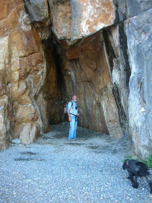
The next stop on the route was St Ninian’s cave which was a short walk along a wonderful stony beach. The stones on the beach were all worn away into ovals and smooth spheres – many of them with intricate veins of different coloured material through them. I picked a couple of really pretty ones to give to Anna as a little memento of our day out.
The cave itself was really more of a fissure that a really deep cave, and there was no actual evidence that St Ninian had actually spent time there – but from the amount of crosses and carvings etc, it was obviously an important pilgrim shrine.
We climbed back up the cliffs and walked along the tops passing the remains of what I think was Feather Castle – I couldn’t find much out about this place and only the arch remains.
After a great walk we descended into the Isle of Whithorn – a small fishing village of about 300 inhabitants.
More Photos
1 Comment | life, photography, Scotland, trail, Travel, trek, Uncategorized, walk | Tagged: Isle of Whithorn, Port William | Permalink
Posted by treb123
June 12, 2009

Above Stairhaven
This weekend I was joined by my sister Anna who came down to walk with me for a couple of days. However today I was walking myself and Anna was going to pick me up after the walk was finished. I parked the van at Glenluce and walked under the underpass on to the minor road towards the little village at Stairhaven. At the far end of Stairhaven the path led steeply up to the cliff top path that led along the cliff top before dropping down to the caravan park at the Cock Inn. The next section was mainly road walking but the road wasnt too busy and there was an opportunity to follow a rough track alongside the grassy verge.
This area is well known for its association with the early Christian church in Scotland – especially St Ninian. Over the next few days I would visit St Ninian’s Cave, church and other historical evidence of the early Christian involvement in this are around Whithorn and Wigton.
The first church I encountered was the remains of the church at St Finian, an early Celtic missionary from Ireland. Not much remained – the outline of the walls and that was about it. I plodded on and before long Anna arrived and I arranged to meet her just to the south of Port William where there was a good place to park for the night.
It was great to have Anna down – it makes such a difference to have a bit of company – even if the person you are meeting doesnt arrive till later – its something to look forward to at the end of a walk.
More Photos
Leave a Comment » | life, photography, Scotland, Travel, trek, walk | Tagged: Chapel Finian, Glenluce, Port William | Permalink
Posted by treb123
May 30, 2009

Luce Sands
Today was going to be an absolute scorcher and I had about 7 miles of sandy beach walking to look forward to. The tides around here go out a long way and when I set off the tide was quite far out. When I eventually reached the three large buoys which which I think might have been used for target practice from the military range, the tide was still along way off. It felt quite isolated – there was noone around as I was quite far out but I could imagine the weekend in Glasgow with thousands of people thronging the parks, eating ice creams and lounging around on the grass.
Although the sun was blazing there was a coolish breeze that managed to make the walking comfortable. Actually the bext days for walking are probably coolish overcast days. Sunny days have their own problems sunburn obviously being one of them. However another problem I get if the sun is strong and especially if it is windy is coldsores. Not very often mind you – (because the sun doesnt shine very often in Scotland), but I felt that tickling feeling on my bottom lip which I knew spelt trouble. Sure enough a couple of days I looked like I had a dead fly stuck to my bottom lip. But it was worth it.
Leave a Comment » | life, photography, Scotland, trail, Travel, Uncategorized | Tagged: Ardwell, Glenluce | Permalink
Posted by treb123
May 29, 2009

Near Ardwell
I left the Mull of Galloway lighthouse on a beautiful sunny day. One of the warmest days so far this year and the whole weekend was due to be a scorcher. I felt slightly strange that I had finally “ticked off” the last cardinal point on my trip around Scotland. The Mull of Galloway is as far south one can go in Scotland. Ahead om from the vantage point at the top of the cliffs near the lighthouse I could see the Maryport Bay towards the north and beyond. I was looking forward to the long strecth of beach walking around the bay at Luce Sands. Probably the last significant beach I would walk along. The ending is fast approaching as I savour the last of everything. The beaches for example – from the beaches at Aberlady, St Andrews and Tentsmuir, Lunan Bay, Balmedie links and around Lossiemouth. Then the most beautiful of all – at Sandwood Bay in Caithness. Arsisaig and Morar sands, Sanna Bay at Ardnamurchan and many many more. Each memory was fading a little and being replaced by the couple of photos form each location that I had blogged here and elsewhere.
I wasnt even sure if I would meet any more lighthouses now. Each lighthouse punctuated my travels like exclamamtion mark or markers. And because they were all built to a similar design by the Stevensons – I took a certain comfort when I reached another one on my travels. I knew that the yellow and white paint would appear familiar to me. Although there were exceptions such a the candy striped lighthouse I passed a long time ago at Tarbat Ness.
Anyway – the time for looking back wasn’t quite here yet and I had a shortish walk along the little country lane that dropped down into the village at Drummore – from there on there was a walk around the road north that ended at Ardwel.
1 Comment | life, photography, Scotland, trail, Travel, trek, Uncategorized, walk | Tagged: Ardwell, Mull of Galloway | Permalink
Posted by treb123

