May 28, 2009

Mull of Galloway Lighthouse
I didnt get down to the south of Galloway until late afternoon on the Friday and so I decided that I’d walk the short distance from Port Logan to Drummore and then set off from the lighthouse the next day. I don’t have that far to go now and so I’m really checking the weather forecast before I leave to ensure the remaining walks I have to do are a pleasure (at least weather-wise!) The forecast wasn’t wrong and the whole country was treated to wall to wall sunshine for the duration of the weekend. That afternoon I was sauntering ( I dont do any other speed) and noticed that everyone else was sauntering too. It was a warm day, about 22 C, which is positively tropical in Scotland and it was great to see everyone in summery clothes just ambling.
I’m a great fan of ambling and Im convinced that there is a correlation between air temperature and the perceived ambling. No doubt the research has been done and is wrapped up in PhD thesis on a forgotten shelf somewhere. Italians amble – have you ever seen a German amble? Never. Even in hot places – they fight the urge to amble but stride purposefully, arms all a-swinging and purple in the face.
Anyway I was looking forward to reaching the most southern point of Scotlandshire tomorrow and turning north and then east for my final leg….
 Leave a Comment » |
  life, photography, Scotland, trail, Travel, trek, Uncategorized, walk | Tagged: Drummore, Port Logan |
  Permalink
 Posted by treb123
April 20, 2009

Portlogan
The final day walk of this weekend and it was a short one of 6 miles before I headed back to Glasgow. The weather was still great and I could hardly believe that I had a run of four days in glorious sunshine. My feet were holding up to with just a tickle of a blister under my toes despite the fact that I hadnt done a lot of walking over the winter. I was tired though – and I also had the beginnings of a friction burn just at the tops of my legs which I had managed to stop getting worse by rubbing baby oil on it. I can understand now why marathon runners end up putting grease on their nipples. It was like a burn on my legs that was being rubbed by sand paper (I know – I’m such a woose)
Leave a Comment » | life, photography, Scotland, trail, Travel, trek, Uncategorized, walk | Tagged: Clachanmore, Port Logan | Permalink
Posted by treb123
April 19, 2009

Portpatrick
Another glorious day and so I got up and out early and started the 4 mile walk along the start of the Southern Upland Way that would lead me down over the cliffs, passed the lighthouse at Killantrigan and on to Portpatrick. Portpatrick is the western start to the SUW which is a tough coast to coast walk of over 200 miles. I have walked half of the walk but had to give up when the foot and mouth epidemic hit our shores – effectively closing the whole of the countryside down. I do remember it being very tough with lots of ups and downs. Maybe one day Ill finish the section from Moffat east that I couldnt do last time.
I like Portpatrick although it was a bit busy with a hen party in full force. I dont know about you, but it is actually frightening to see a posse of pissed up women all wearing pink stetsons lumbering towards you.
Anyway the cliff path to the south was a good walk – the ruins of Dunskey castle is impressive against the skyline and later the path looks down onto the Morroch Bay. From then on to the finish the walk is mainly on small farm roads.
Leave a Comment » | life, photography, Scotland, trail, Travel, trek, walk | Tagged: Clachanmore, Portslogan | Permalink
Posted by treb123
April 18, 2009

North of Stranraer
I got off early and started walking north away from Stranraer around the west shore of Loch Ryan – This is the time of the year that I love. Early spring always brings with it a period of sunshine that seems to awaken the countryside. Suddenly the trees are awash with green buds bursting out – the colour of the green is even different – it is a clean new colour. The other evocative feature at this time of the year is the strong pungent coconut aroma of the gorse in bloom. I think that of all the memories I will have of the last four years on this walk – the smell of the scent of the flowering gorse bushes on a warm spring day will always be with me.
The walk itself was a straightforward walk around the northern section of the Rhins of Galloway. I followed minor roads all the way and there was little traffic apart from the occasional tractor. I skirted the Carsewall lighthouse at the north then turned and headed south along the B738 till I reached Portslogan. It was a long walk (for me) at 18 miles but apart from a bit of chaffing I completed it unscathed.
More Photos
Leave a Comment » | life, photography, Scotland, trail, Travel, trek, walk | Tagged: Galloway, Portslogan, Stranraer | Permalink
Posted by treb123
April 17, 2009

Cairnryan Ferry

Ayrshire Coastal Path guide book.
This was the first walk of 2009 and I had been putting it off until the weather looked settled for a few days. I have approximately 200 miles or so to go before the end of the walk and Ive decided not to blast away at it but to savour the last miles. The most difficult part of this project has always been the way I have to “psyche myself up” before I head off. By that I mean that it does at times seem a ridiculous project to have started and there always ensues a battle of wits with myself as to why I should drive a couple of hundred miles just to wander around muddy fields and farm roads for a few days when I could be spending time doing other more “worthwhile” activities. However I always tell myself that this has as much vailidity as anything else when all is said and done. – I’m out in the fresh air – I am getting fit and Im closer to nature than sitting in an air conditioned office all day.
I arrived down at Stranraer and caught the bus back to Cairnryan which was only about 6 miles away – so it was a good re-introduction into the walk after the winter. The sun shone and I felt the warmth on my face and got into my stride. The path went around the loch side – mainly on the road with the occasional foray to the sea shore and I was back in Stranraer in no time.
I received a comment from Jimmy Begg who coordinates the Ayrshire Coastal Path. He says that there will be an extension from the end of the coastal path at Ballantrae to Stranraer, which will also link up to the Southern Upland Way. This is excellent news and Jimmy should be commended for the hard work he and his team at the Ayrshire Rotary club have put in to raise the funding to create Ayrshire path. Piece by piece the coastal path is slowly coming together. We just need to link the various sections and eventually there will be an official route around Scotland. To this end I have been putting together a web site at www.nationalcoastalpath.co.uk to lobby for the creatiion of such a path.
More Photos
3 Comments | life, photography, Scotland, trail, Travel, trek, walk | Tagged: Cairnryan, Stranraer | Permalink
Posted by treb123
October 24, 2008

Emma and me on the Ayrshire Coastal Path
Ayrshire Coastal Path guide book.
I travelled towards my starting point for the walk the previous evening and sat in the van in the Irvine and saw that the weather forecast was going to be really horrendous the next day with 35 mph winds and driving rain all day. I decided that I didnt need to put myself through that especially as a major part of the walk was going to be across a high hilly area. So I drove back to my sisters in Glasgow and bullied my daughter Emma to come down the day after and walk with me for the day.
The weather wasnt bad when we set off and fortunately stayed dry all day. The only problem was that when we eventually set off from Ballantrae after stopping off at the cafe in the local garden centre for a quick bacon roll it was already after 11 am. I reckoned that we would be reaching our destination in Cairnryan in the dark. Setting off from Ballantrae I followed the the Ayrshire Coastal Path towards the hill south of the village named Downan Hill on the map. However Im not sure if we missed the turning as the path we were following kind of “ran out” idecided to double back and follow another path which lead eastwards towards the farm at Meadow Park. It wasnt a big detour but it was a tad annoying as a signpost at the outbuildings at Downan would have cleared up the confusion. We carried on an followed minor farm roads until we had to skirt Eastwards around Sandloch Hill. This led us down the hill till the path eventually ended at the junction of the main A77 road and the start (or end) of the Ayrshire Coastal Path. The rest of the walk was along the main road which led down into Cairnryan – a very busy road used by the lorries and traffic coming over from Ireland off the ferry at Stranraer. By the time we eventually reached Cairnryan it was already dark and we had to be very careful that we got off the road quickly as the traffic came around the bends. I cant remember the last time I ever finished a walk in the dark, or even if I had done at all. This is the latest time in the year that I have walked on the Coast walk and Im suddenly conscious that in four weeks time it will be dark at four and Im realistically going tp have to question whether this “final push” to finish the walk over the winter is worthwhile.
![Reblog this post [with Zemanta]](https://i0.wp.com/img.zemanta.com/reblog_e.png)
2 Comments | life, photography, Scotland, trail, Travel, trek, walk | Tagged: A77 road, Ballantrae, Cairnryan, Stranraer | Permalink
Posted by treb123
October 16, 2008

Ballantrae
Ayrshire Coastal Path guide book.
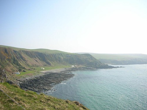
From Girvan the road leads south along the main A77 which can be pretty busy as there are lots of big lorries that travel north along this road from the ferry port at Stranraer where they come over from Ireland. The road narrows at a place called Kennedy’s Pass (the Kennedy’s controlled this land years ago and Im sure they did their fair share of extortion and racketeering like every other Scottish Clan) There was a sign for the Ayrshire Coastal Path that pointed across the road, but after following a landrover track up the hill in the wrong direction I doubled back and decided that I’d stick to the coastal road even if it was busy.
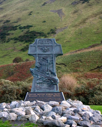
Just beyond Lendalfoot there was a memorial in the car park by the sea to a Russian Ship called the Varyag which ran aground not far from the shore. The road then climbed up to the summit of the pass and ahead of me lay Ballantrae and beyond Loch Ryan and Stranraer.
More Photos
Leave a Comment » | life, photography, Scotland, trail, Travel, trek, walk | Tagged: A77 road, Ballantrae, Girvan, Loch Ryan, Stranraer | Permalink
Posted by treb123
October 12, 2008

The Ailsa Craig
Ayrshire Coastal Path guide book.
From Maidens I took the road that ran in front of the famous
Turnberry golf course – Im not sure if the path went around the shoreline or not but I couldnt see a signpost at Maidens harbour for the Ayrshire Coastal Path so I missed out on a photo of the lighthouse at Turnberry. I did pass the front entrance to the 5 star Turnberry Hotel however – it is probably up there with the Gleneagles Hotel as being one of the top hotels in Scotland. Invariably linked to to a golf course of course. Turnberry has been the venue for many an
Open championship. Once I passed Turnberry I headed down the very busy A719 which runs along the shoreside south to
Girvan. Once again I wasnt sure if there was a viable alternative along the shoreline but I didnt see any signposts suggesting otherwise. So I plodded on and did my hopping on and off the grass verge act until I reached the outskirts of Girvan. That night I parked at the harbour behind a Turkish Articulated lorry. The next morning I watched as the driver ate his breakfast from the side of a little pull down flap on the side of the lorry. He brewed up some strong coffee on a little makeshifts kettle and sat on a little fold away chair. I wondered how he must have felt being so far away from home. I was wondering what I was doing parked up in amongst a lot of trailers – I suppose it must be second nature to these long distance lorry drivers. How many of us realise what kind of life it must be living in the cabin of your truck catching some sleep and driving for hours and hours along strange roads in strange countries where you cant presumambly even speak the language. It must be difficult and a lonely life being a long haul lorry driver. God knows if I can anxious if I have a few hours to kill before bed and Im faced with a few hours in the van. And I have all the comforts built in. I always try and ensure I have enough downloaded programs I can watch from the BBC website. The I-Player is a real boon to me as watching some stuff on my notebook PC it allows me to live a little like a “normal” lifestyle when Im away. The rest if the time Im better not thinking about how ridiculous this project is. Part of me wishes it was over and yet another part of me wishes paradoxically it could go on for ever.
More Photos
Leave a Comment » | life, photography, Scotland, trail, Travel, trek, Uncategorized, walk | Tagged: Gleneagles Hotel, The Open Championship, Turnberry | Permalink
Posted by treb123
October 11, 2008

Sunset at Maidens
Ayrshire Coastal Path guide book.
I drove down early from Glasgow conscious that the days were getting shorter and my walk could be finishing in the dark. I caught the bus from Maidens back up to Ayr and started my walk south heading towards the cliffs that form the Heads of Ayr. I walked under
Greenan castle which clung to the cliff precipitously and walked under the cliffs by the shoreline. I wasnt sure if the new
Ayrshire Coastal route followed this direction or took a route above the cliffs but I decided as the tide was out I wouldnt risk trying to clamber up to the top.
The setting up of a coastal path for walkers is a commendable venture and was organised by the rotary club of Ayrshire. However the way marking needs to be improved – just beyond the harbour at Dunure I ended up walking across a field having followed a sign that seemed to indicate the way followed the shoreline, but I had to double back when it seemed that I had taken the wrong route. The official web site for the Ayrshire Coastal Path does not give directions, presumambly because they want to encourage people to but the guide book. However mobile web technology is upon us and it seems that it should be easier to consult a route description via a web browser on your phone or PDA. Thats my opinion anyway – but well done the rotary club for creating the route. Now if we could only get all the sections joined up and create a National Coastal Path….:P
The next stop on the way was the little harbour at Dunure with the Dunure Castle beyond. From there I headed up the main road and past the “Electric Brae” which was meant to be an optical illusion that fools you into thinking that the road went uphill rather than down. I couldnt see it myself although I remember being fascinated at the idea of it when my dad would stop the car on the road when my sisters and I went to visit my gran who lived in Girvan. I dont think it worked then either. I think the gradient was 1:84 or something anyway so its not like the car was likely to accelarate at an alarming speed down the hill.
I cut back in towards the shoreline at the caravan park road that led down towards the beach at Culzean Bay. The walk along the sand and for a few minutes my mind had suddenly cleared of all thoughts and I just felt the warmth of the sun and the sound and the smell of the sea to smother me. It was an extraordinary feeling of “this is what’s its all about”. All the financial turmoil in the world’s markets evaporated, the fact that Scotland couldnt score against Norway in the world cup qualifying match – and all the worries and concerns just left me and felt calm and my mind was just a receptive vessel to my environment. Now I know this sounds like new age hippy crap and I AM Mr Cynical at the best of times, but for maybe 5 minutes I was connected to something much bigger than myself and my little insignificant life was put in perspective. An Existentialist “being in the moment” feeling. There was nothing Nihilistic about it though. It felt good. And to quote a line in my favourite film the Big Lobowski.
Donny: Are these the Nazis, Walter?
Walter Sobchak: No, Donny, these men are nihilists. There’s nothing to be afraid of.
The sun was starting to go down under Culzean castle -an impressive pile now in the stewardship of the National Trust. I had a chat with a couple of women who were renting the cottage at the foot of the cliffs and then climbed up and walked through the castle gardens on my way to Maidens. Unfortunately it was getting dark and didnt really have sufficient light to take photos of the autumnal colours on the leaves of the trees.
I used t visit Culzean when I lived in Glasgow and it would be nice to come back down again withmy camera and spend some time in the gardens. When i reached Maidens I was rewarded with a lovely sunset (see photo above) with the Ailsa Craig just peeping over the horizon.
All in all it was a longish walk but a very satisfying one.
More Photos
Leave a Comment » | life, photography, Scotland, trail, Travel, trek, Uncategorized, walk | Tagged: Ayrshire, Culzean Castle, Dunure Castle, Girvan | Permalink
Posted by treb123
September 28, 2008

- Ayr
Ayrshire Coastal Path guide book.
A short walk today with much better weather. I hopped on the train back up to
Troon and walked along the Barassie Beach towards the harbour area of Troon. The route led on to the esplanade at
Prestwick which was a lovely walk in the late autumn sunshine. I walked along to the end of the esplanade but missed the signpost along the beach at the end of the esplanade. so I had to head inland a little following the
Sustrans cycle route through the back streets until I reached the other side of the golf course. From here I walked passed a rather run down industrial estate complete with gas works. The road then took me along the main street after crossing the bridge over the river. A lovely short walk and a welcome change from yesterday’s rain soak.
Leave a Comment » | life, photography, Scotland, trail, Travel, trek, walk | Tagged: Prestwick, Sustrans, Troon | Permalink
Posted by treb123
September 27, 2008

Sunlight on the Ayrshire Coast
Today’s walk was a long one – much longer than I had planned however. I parked the van on the beach at Troon making sure it wasnt going to sink into the sand and I would be able to drive away again. That happened to me on a beach on an earlier walk and I didnt want to repeat the experience. I caught the first train back up the line to West Kilbride Station and headed down through the lovely park that led down to the main coastal road. The walk along the road that ran along past Seamill towards Ardrossan reminded me of when I was a young lad and came down here for my holidays. Everything had shrunk in size. When I was a young lad Seamill was a magical place seemingly filled with exquisit rock pools and what I remembered to be a beautiful sandy beach. It wasnt any of those things now – just a sad scrap of sand next to a car park. The world is certainly more magical when your too young to know any better.
Ayrshire Coastal Path guide book.
I headed in Ardrossan and on towards
Saltcoats. I was sure when I was a lad there was sand on the beach but there disnt seem to be any here now. Something to do with the Council’s health and safety policy perhaps? Perhaps sand was deemed to get into people’s eyes and it had been removed for our own good.
I had intended to walk towards Irvine and cross the footbridge that went over the mouth of the river Garnock. I had read in David Cotton’s blog that the footbridge had been built to connect the new museum called the Big Idea. However on double checking I found that the museum was closed due to funding issues and the bridge was kept open permanently to allow shipping to travel up the river Garnock. I was extremely pissed off with that news as not only would I have to detour inland towards Stevenson adding about 5 miles or so to my journey, it would also mean missing out on a great beach walk along the coast. I couldnt do anything about it and therfore followed the Sustrans cycle signs inland. The journey was not a memorable one – as the route ran behind old industrial estates where I had to navigate an underpass where three of four Yoofs were quaffing Scotland’s other National drink. No – not Irn Bru but Buckfast. That had me slightly on my guard as I passed them, but they were fine and said hello as I passed.
Eventually the route turns back towards Irvine and eventually I reached the harbour area which had been given a make over. It did look quaint with its street lamps – it reminded me of Sheidaig for some reason but obviously a modern attempt at making a place look older. When I enquired about the bridge being closed they said that it might open again as there were moves afoot to create a golf course complex on the other side of the bridge. Now where have I heard that before?
I had a coffee in a little coffee shop then headed out into heavy rain for the final walk along Barrassie beach towards Troon. I caught absolutely soaked through – my jeans and feet were sodden and I collapsed into the campervan and was really exhausted at the end of this walk.
More Photos
Leave a Comment » | life, photography, Scotland, trail, Travel, trek, Uncategorized, walk | Tagged: Ardrossan, Garnock, Irn-Bru, Saltcoats, Scotland, Seamill, Sustrans, Troon | Permalink
Posted by treb123
September 26, 2008

Largs
Ayrshire Coastal Path guide book.
I left the van at West Kilbride railway station and intended getting the train back up the line to Wemyss Bay. However when I looked at the train timetable I realised that the train didnt go as far as Wemyss bay, but stopped at Largs. When I got to Largs there didnt appear to be a bus service on a Friday up to Skelmorlie. So reluctantly I decided to just walk south from Largs. I started off having a coffee in Nardini’s coffee shop on the corner. Nadini’s was a cafe that was synonymous with Largs, but Im sure that it had moved and now occupied a corner position. When I was a little boy I would come down to Largs to go sea fishing with a friend – in those days it was still possible to catch lots of fish in the waters around Largs – Cod, Mackerel and many others. I think you would be catch anything around here now. The ferry for Millport on the Isle of Cumbrae also leaves from Largs – another favourite summer day out for me when I was younger.
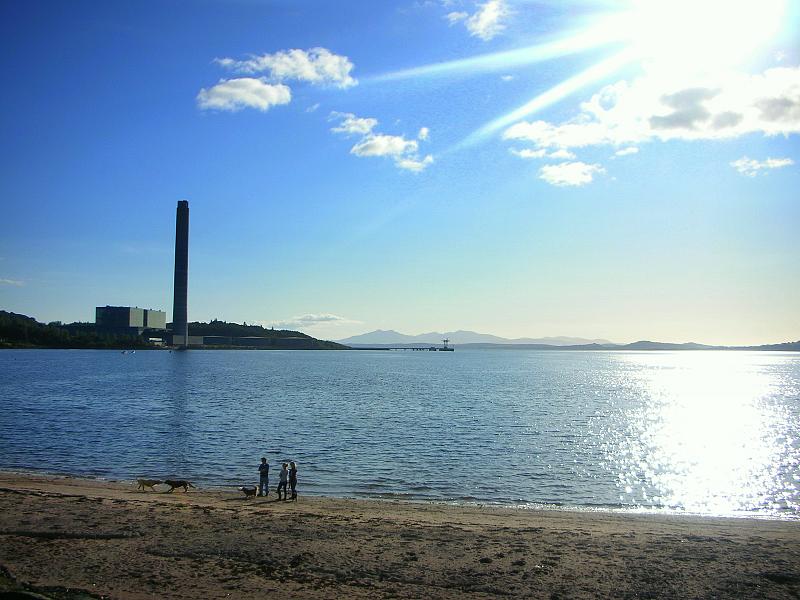
On my way around toawards the Hunterston Power Station I met a guy called Bob who turns out knew my daughter’s boyfriend, having played with him in his band “El Dog”. We had a great walk together and it was great to meet him as we had a great chat and he was good company. Together we chatted about music and all sorts of stuff. I hop he catches the coastal walking habit. 😉
From the Power station we rounded the bend at Portencross, we passed the remains of the castle and then it was a a mile or so back up the hill to West Kilbride railway station where I jumped in the van and headed down towards Troon where I spent the night at Barrassie beach.
Leave a Comment » | life, photography, Scotland, trail, Travel, trek, Uncategorized, walk | Tagged: Largs, Nardini, Portencross, Skelmorlie | Permalink
Posted by treb123
September 22, 2008

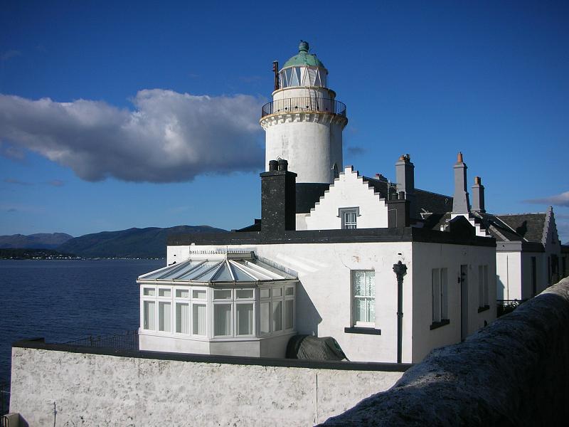
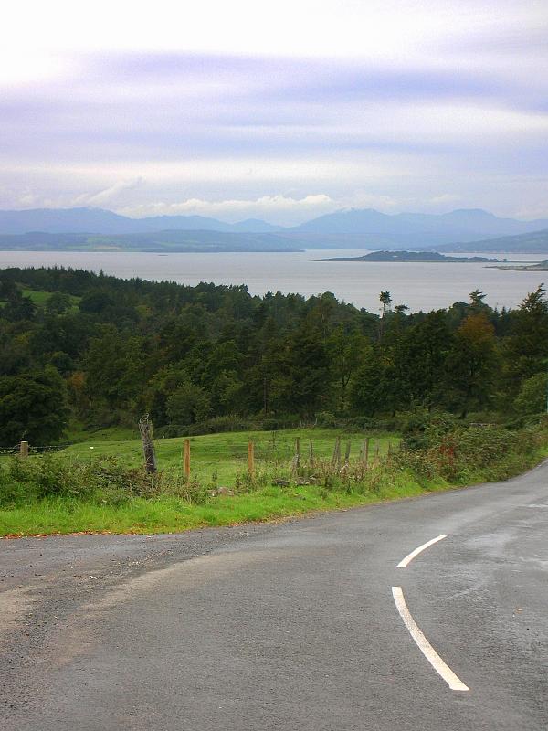
The Rothesay Ferry
Today was a great day for a walk – lovely warm late September sunshine only served to remind me how much I love the autumn in Scotland. We havent had a summer this year so it was lovely to actually walk along the sun warming my shoulders. Over the months my fleece has developed a musky odour which isnt unpleasant but always will remind me of all the walks I have done. Once the sun shines and I up the pace a little I detect the scent of long arduous miles that have come and gone. I am finding it more difficult to look forward rather than back now; probably because the bulk of my walk is completed now and there is only a couple of hundred miles to go till the end. I get flashbacks in my mind of places I have visited – that I cant place in my mind where they are exactly. Similar curves of a road – a certain way the light falls on a hill or on the sea. I am also if truth be told getting a bit melancholy about the whole thing – I think partly its because I know winter is just around the corner. The cooler days are ahead – and with it comes the associated smells of decaying leaves and woodsmoke. The colours on the trees are turning and I think we will have a spectacular display this year.
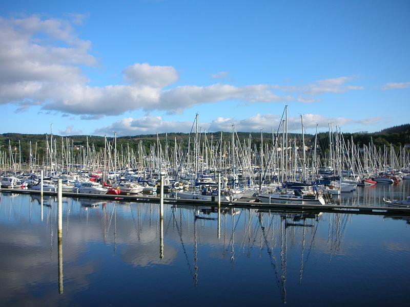
I walked around the “bend” at Gourock after passing through the shipyards of Greenock and started heading south. I could see over the Clyde towards Dunoon and felt I had come a long way since Inverary. I passed the Cloch lighthouse and moved along south. There was a path off the main road which led on past the forest of masts from the yachts at Inverkip marina. Eventually the looming chimney from the Huntertson power station got closer and closer and it was strange to think I had gazed on that from across the water and wondered then how long it would take me to reach the point where I was now.
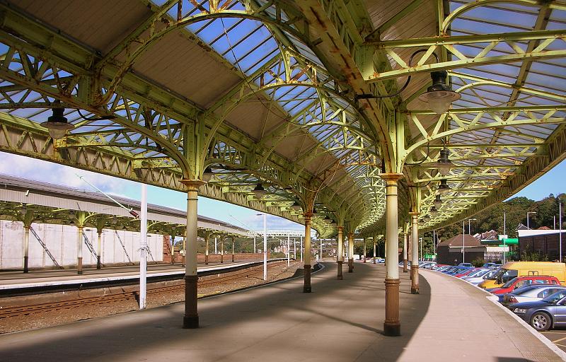
As I approached my final destination, which was the railway station at Wemyss Bay, (which surely has to be one of the most photogenic railway stations in Scotland), I caught sight of the ferry steaming from the pier towards Rothesay on the island of Bute. A lovely end to a lovely day’s walk.
More Photos
Map
3 Comments | life, photography, Scotland, trail, Travel, trek, Uncategorized, walk | Tagged: Dunoon, Gourock, Greenock, Inverkip, Scotland, Wemyss Bay | Permalink
Posted by treb123
September 18, 2008

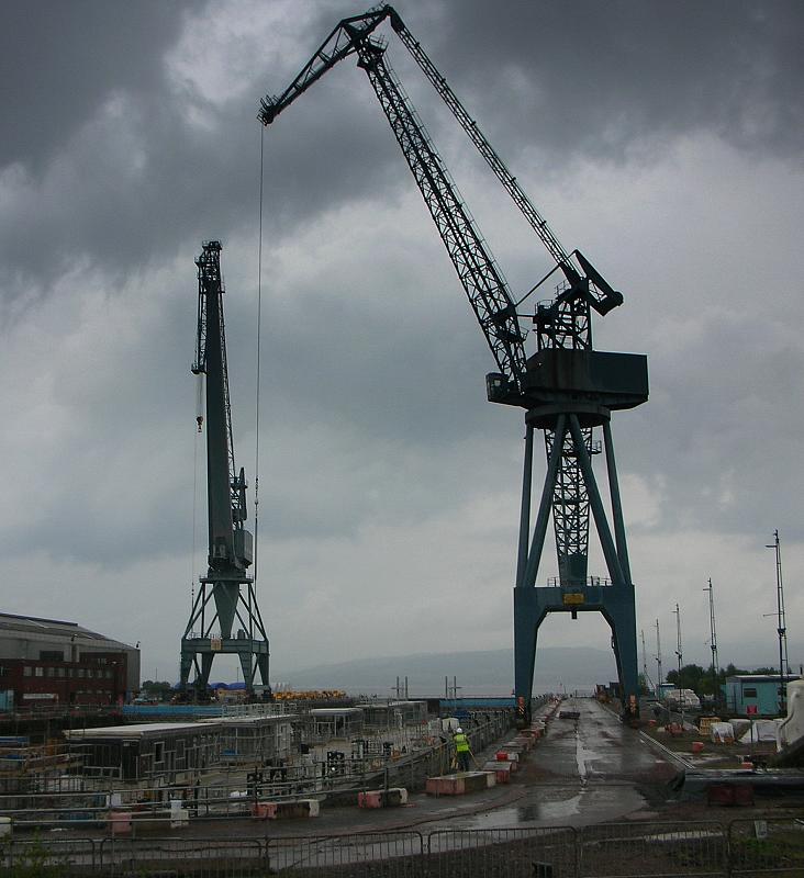
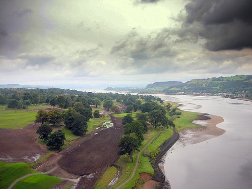
Greenock
Today I was heading over the Clyde. I caught the train from Glasgow to the small station at Kirkpatrick which lies just under the Erskine Bridge. See the photo from the previous post of the view over the bridge. It was great to look back down the Clyde and see the hills away to the west. The convulated shoreline of Argyle seemed to take forever to get round and although at times I wished it was all over I felt sorry that I had now left the Highlands behind and it was a long stretch of shoreline south along the Ayrshire way that faced me next.
The weather wasnt good as I crossed over to the south side of the Clyde and headed through Bishopton towards Greenock. I passed the hospice at Erskine that looks after old soldiers and it was well known in Scotland. I then had to walk along the very busy dueal carriageway of the A8 which had no footpath. I was therefore keen t get off this busy and dangerous road and so once I got to Langbank I headed inland a little so that I could get a better view of the Clyde Estuary which I could see from a higher point.
I eventually dropped down a little into Port Glasgow which was a pretty run down area with many houses boarded up. It was a shame as the view from where they were built was priceless. You coud see all the way up the various sea lochs and towards the Arrochar Alps. It did feel strange to look back northwards towards those mountains that I went through only weeks before.
From Port Glasgow it was a short 3 miles walk into Greenock where I stopped at the station to catch the train back to Glasgow via Paisley.
More Photos
2 Comments | life, photography, Scotland, trail, Travel, trek, Uncategorized, walk | Tagged: Arrochar Alps, Erskine Bridge, Firth of Clyde, Greenock, Langbank, Port Glasgow | Permalink
Posted by treb123
August 31, 2008

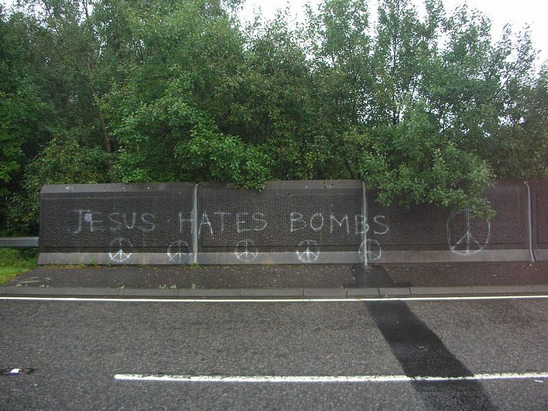
Lochgoilhead
Day 2 of Michael’s walk and he decided to change from his walking boots to trainers which made life a bit easier for him. Today the weather was the usual dreich misty rain but it didnt matter that much as most of the walk was to b e down the A814 which runs the length of the east shore of Loch Long. For most of the day the loch was obscured by bushes and trees anyway so we didnt really get a chance to see much. We did see an usual Chinese garden by the side of the loch about half way down with a pagoda and the works.
By the time we had reached the outskirts of Garelochhead we were pretty wet and the rain had done its business and managed to work its way through the wet weather gear we had on. Even Arfur was looking a bit pissed off. We stopped at the beginning of the dual carriageway that led to the refuelling base at Coulport. If Michael hadnt been with me at this point I could honestly say I would have been hard pressed to stay positive about this walk. Near a bridge that had “Jesus hates bombs” written on it, we stopped and ate some soggy sandwiches. Then we had a long drag up and over the hill along the dual carriageway down to the Coulport base. A police car stpped and enquired what we were up to – Obviously wondering what a couple of dishevelled soaked middle aged men were doing walking along a military zone. I was also beginning to wonder myself what I was doing at that point.
More Photos
Map of Area
1 Comment | life, photography, Scotland, trail, Travel, trek, Uncategorized, walk | Tagged: Coulport, Garelochhead, Loch Long | Permalink
Posted by treb123
July 7, 2008

Inveraray Harbour
Another shortish walk from Furnace to Inveraray. The village of Furnace lies on the western shore of Loch Fyne and got its name from the 18th Century Furnace that was built there. The abundance of wood and iron ore around the area was an ideal place to create a place to smelt iron in the 1700’s. I managed to get off the main road that led to Inveraray which was a pleasant change as I was getting fed up dodging traffic. After the shoreside path ran out I dropped into the caravan site to see if I could get a coffee and use the toilet. The café cum pub was closed because there was no customers the lady informed me. I think that people are really feeling the pinch – and those who would normally spend two weeks of the “Fair Fortnight”, as the annual holiday in Glasgow is known as, are feeling the pinch more than everyone else.
It was no time at all when I reached Inveraray, having only walked about 3 hours in total. The town consists of a main road with white washed houses on either side and a pier where the “Vital Spark” which I last saw in Lochgilphead was tied up. The Scottish Maritime Museum boat was also moored at the pier. I like Inveraray – it has a great hotel in the George which lies at the top of the road. Last time I was here I saw a wedding where everyone was gathered outside the church watching the bride and groom leave. The groom emptied a bag of coins onto the road for a “scramble”. All the children would scurry about picking up the money – I had forgotten about that custom and it reminded me of being a boy and hearing that there was a wedding on. Mt friends and I would all rush to whatever church was having the ceremony and hope to get lucky. Sixpennies were like gold as the rest would be threepenny bits and coppers. It was vicious with elbows and knees used to be the first to get to the silver.
Inveraray also has an impressive castle, the clan seat of the Campbells so being a Campbell myself it was interesting to see again. Argylle is Campbell country but its probably fair to say that they were the shrewdest clan in the highlands using the law to gain the lands they had reather than brute force as was the way of the clans in the Highlands.
More Photos
1 Comment | life, photography, Scotland, trail, Travel, trek, walk | Tagged: Argyll and Bute, Inveraray, Loch Fyne, Lochgilphead, Scottish Maritime Museum | Permalink
Posted by treb123
July 6, 2008

Inveraray Main St
Another easy day – a wee bit more than yesterday but I’m enjoying having more time and being lessknackered at the end of the day. Im also getting a chance to update this blog more or less as I go along rather than have to try and remember what happened sometimes weeks after the event. The walk was along the main road but I brought a Dictaphone I had in the van. Sometimes it helps to just spout forth about random thoughts and record them for posterity. Or perhaps this is the first signs of madness. I’m using the Dictaphone to cover for the fact that Im actually talking to myself out loud and this little piece of equipment somehow legitimises the activity. Maybe Im not 100% nuts yet – I’ll leave that for others to ascertain. That night I wandered around Inveraray which is a favourite town of mine with its white houses and a great hotel called the George. Last time I was here I had fish and chips but I think Ill give it a miss this time cos despite the walking I do, I still carry a couple of extra pounds . It’s my genes Ma!
Leave a Comment » | life, photography, Scotland, trail, Travel, trek | Tagged: Lochgair, Minard | Permalink
Posted by treb123
July 4, 2008

The Arran ferry near Skipness

Kintyre Way E-Guide
I got back with my phone repaired which meantI could see where I was going with my OS maps loaded again.It was a lovely sunny day and the views over to Arran were stunning. I could see the notched ridge of A’ Chir and Goatfell clearly, and the view from this side of the island was much more dramatic than the one you see on the ferry from Ardrossan which is the more busy route. Years ago, I had climbed A’ Chir with my sister on a gloriously warm Easter Sunday. Unfortunately Anna balked at the idea of walking along the ridge and we had to come off the side. (which is something you should never do) Anyway we did have a few scrapes and bruises and eventually managed to get back to Broadick in one piece although we did miss the last ferry home. We also go a ticking off from one of the mountain rescue guys who happened to own the B&B for chosing that route off the mountain. I knew it was not the best option but I felt we didn’t have any other choice at the time.
Anyway, although the walk was pleasant enough – the flies drove me nuts. If there is little wind, the road is next to a wooded area and the sun is shining then, these swarms of balck flies appear. At least with midgies if you keep walking, they don’t bother you as much. But I felt like the character Pigpen from the Charlie Brown cartoon strip with a massive swarm of them flying about my head.I had my lunch at the little beach at Grogport and then stopped at the ferry terminal at Claonaig. I watched the ferry coming back from Arran and then ventured the last couple of miles over to Skipness. There was a crowd of adults and children celebrating 4th July with stars and stripes top hats on. I also bumped into the lady I had met in Tayinloan who had asked me to put the sheep the right way up. Her son was playing at the ceilidh that night at Skipness village hall. I didn’t feel up to a ceilidh having just walked 16 miles or so. The 13th Century castle at Skipness is quite impressive and I enjoyed having a wander around there in the cool evening light.
Leave a Comment » | life, photography, Scotland, trail, Travel, trek, walk | Tagged: Carradale, Claonaig, Kintyre, Mull of Kintyre, Skipness | Permalink
Posted by treb123
June 26, 2008

Beach near Carradale
Kintyre Way Guide
I drove to Carradale and caught the bus back to Campbeltown. I set off heading north and decided that I needed to do somethingtopace myself as I was having trouble with blisters and a a niggling left ankle. I decided I would have a 10 minute break every hour rather than what I usually do which is to walk for 3 hours or so without a break.The walk was a pleasant one and soon I left the island of Davaar, behind. I hadn’t realised that the island is connected to the mainland with a causeway which is covered in high tide.I passed through the village of Saddell with its ruined Abbey and carved stones. I also had a short chat with an old man who had lived in Saddell all his life. I often wonder if people who haven’t travelled, but stayed put are any happier than those who have wandered across the globe. He seemed a happy old man with his two old collies and I secretly envied his apparent sense of belonging .
Eventually I got to Carradale which is a lovely little village. Full of signposts everywhere which is always a sign of an (over?) active village committee. What was silly and rather pointless was the fact that the signs had the names of the organisations that had “sponsored” the production of these signposts blazoned over the signposts themselves. So a simple sign pointing to the “Beach” had maybe other four other names underneath like “the lottery fund” etc. under it.I’ve seen this phenomenon all over the place, especially when it comes to the European Union. There might be a little insignificant bridge somewhere that has a huge pronouncing sign saying “This project has been part funded by the European Union”.In case you forget it.
Carradale was a lovely well kept village nonetheless. I parked down at the car park at the pier and watched the boats unloading their catches late at night. The fishermen definitely don’t do a nine to five job here.That night I ventured further up the village to find a place to charge my replacement phone and ended in the village pub taking part in the Thursday night quiz and watching a bit of the Euro 2008 football competition.
More Photos
Leave a Comment » | life, photography, Scotland, trail, Travel, trek, walk | Tagged: Campbeltown, Carradale | Permalink
Posted by treb123
June 25, 2008

Looking back to Mull of Kintyre
NEW : See my campaign to establish a National Coastal Path here
Kintyre Way Guide
I had turned the corner and started heading back north today up the other side of the Kintyre Peninsula. After yesterday’s grim weather it was lovely to walk in sunshine again.20 Miles away I could see the isolated rock of the Ailsa Craig or “Paddy’s Milestone” as it is also called. It was interesting to see it from the “wrong” side.The Ailsa Craig was the place that granite for curling stones was mined. My Gran worked in the canteen on the island. Another nice place to see was the island of Sanda which lies just to the south of Southend. Years ago I sailed on a skippered yacht out of Troon and we anchored just off Sanda as we waited for the tide to turn and head north up towards Gigha island. It was a magical trip, especially as we were sailing at night. This was way before GPS was used for navigation and everything had to be plotted out using compasses and real paper navigation charts.I remember looking out for the light on Rathlin island off the Irish coast and the sense of relief when suddenly it came into view.
I was tired when I got back to Campbeltown and the last couple of miles around Campbeltown loch was a bit of a struggle.
More Photos
Leave a Comment » | life, photography, Scotland, trail, Travel, trek, walk | Tagged: Campbeltown, Kintyre, Kintyre Way, Mull of Kintyre, Southend | Permalink
Posted by treb123


